
Split Catchment
Overview
The split catchment process (nldi-splitcatchment) divides an NHDPlusV2
catchment polygon into an upstream and a downstream portion using a precise
location along a flowline. This location is typically derived from a
raindrop trace
.
The process optionally returns the full upstream drainage basin.
How the Algorithm Works
The process requires a coordinate (lat/lon). Internally, the raindrop
trace algorithm identifies the hydrologically correct position along the
nearest flowline.
Given this flowline position, the algorithm:
- Identifies the local catchment polygon associated with the flowline.
- Splits this polygon into two parts:
- The upstream portion draining to the linear-reference point
- The downstream portion below the point
- Returns both polygons as separate GeoJSON geometries.
When upstream is true, the upstream split polygon is combined with all
upstream NHDPlusV2 catchments to produce a complete drainage basin.
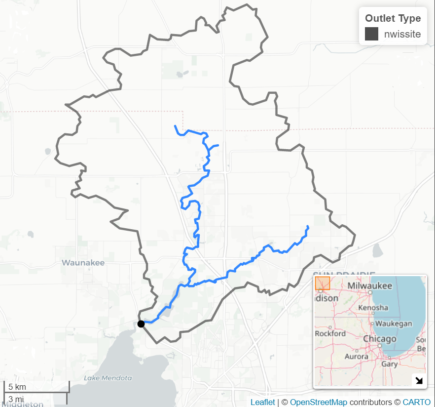
A stream gage (black dot) at the outlet of a drainage basin. When a point does not coincide with a natural basin outlet, the split catchment algorithm derives a precise boundary.
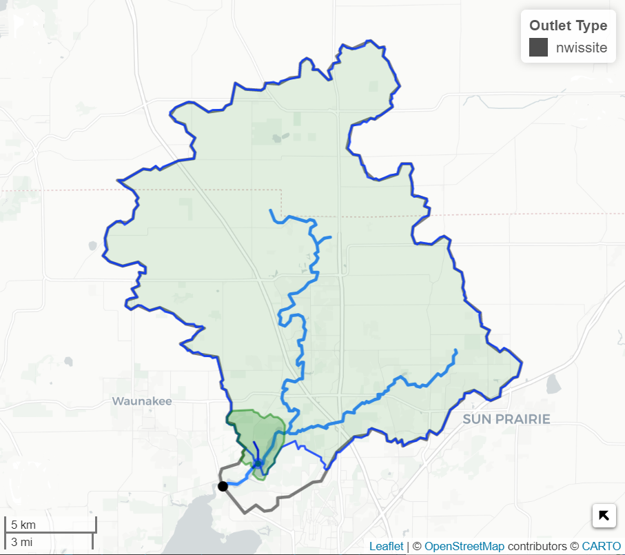
The resulting custom-delineated basin, produced by combining the split catchment upstream polygon with all upstream NHDPlusV2 catchments.
Role in Basin Delineation
Combine the split catchment output with the NLDI upstream accumulation (basin retrieval) to create a precise drainage basin for any point along a flowline.
This workflow:
- Ensures that the downstream limit is placed exactly at the user-defined location
- Produces a basin boundary that better reflects the actual drainage divide, since it splits the local catchment rather than using its full extent
- Supports use cases such as custom watershed boundaries or flowpath-specific studies
See Basin and Hydrolocation
for how
splitCatchment=true triggers this process from the core NLDI basin endpoint.
Example Request
Split the catchment at a point near Madison, WI and return the full upstream drainage basin:
POST https://api.water.usgs.gov/nldi/pygeoapi/processes/nldi-splitcatchment/execution?f=json
Content-Type: application/json

{
  "inputs": {
    "lat": 43.0864,
    "lon": -89.35,
    "upstream": true
  }
}
When upstream is true, the response includes three GeoJSON geometries:
the local catchment, the splitCatchment (upstream portion of the local
catchment), and the full drainageBasin (all upstream catchments combined
with the split portion). When false, only the local catchment and split
catchment are returned.
Explore the Full Parameter Schema
The pygeoapi process description provides the complete parameter schema:
/processes/nldi-splitcatchment?f=json